Smarden Churchyard grave and burial list and locator map
Last Updated on June 6, 2025 by admin
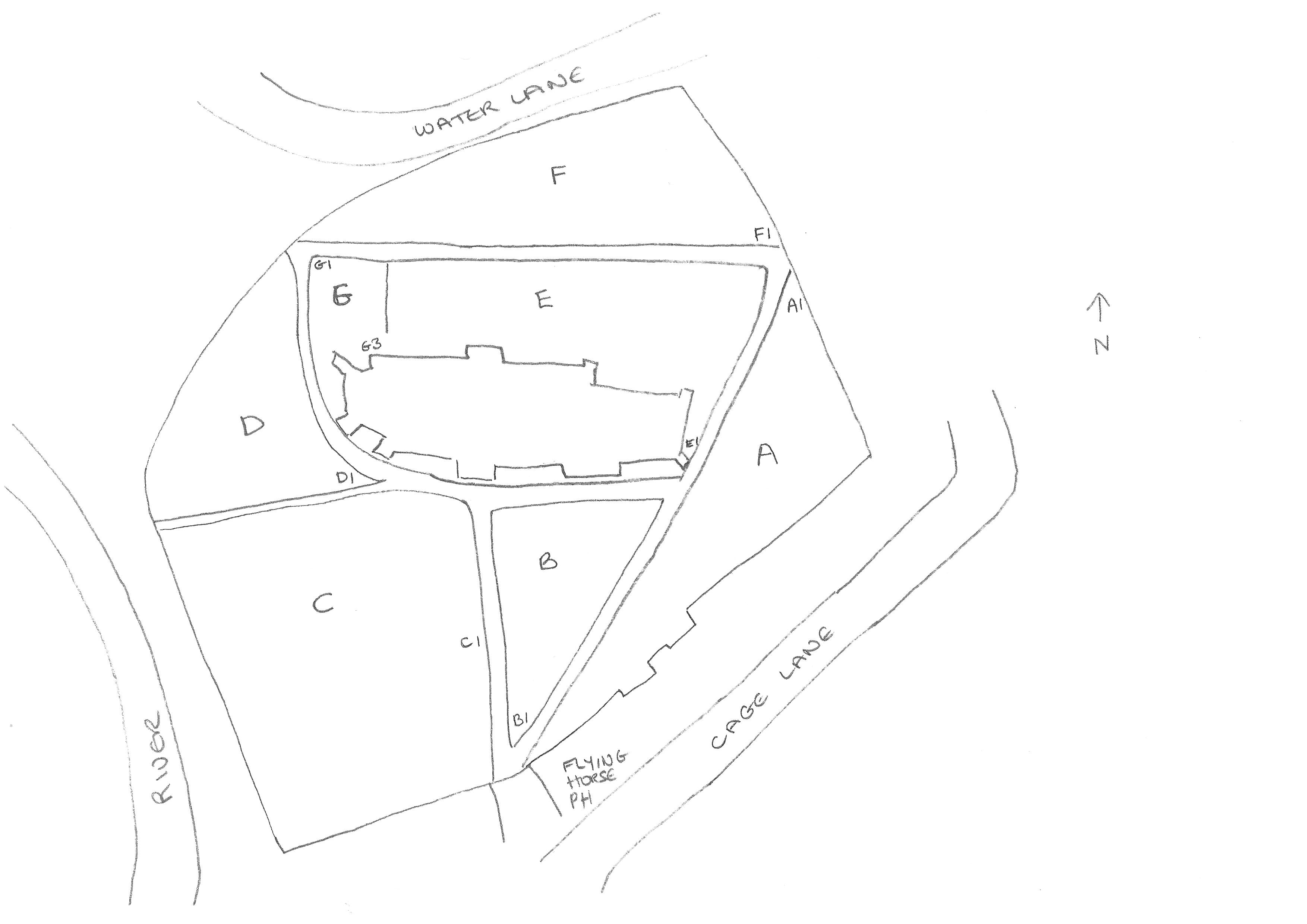
This page is intended to locate a particular grave in St. Michael the Archangel Churchyard. The information is also available as hardcopy. Please contact the Benefice office for further details.
How to use this page
Download the Alphabetical list (click link below) and note the reference for the names you are seeking:
Alphabetical list of burials (Smarden Churchyard)
Area D (Smarden Churchyard)
Area E (Smarden Churchyard)
Area F (Smarden Churchyard)
Ashes plots (Smarden Churchyard -up to 2017)
The PCC of St. Michael the Archangel, Smarden, is very grateful for the careful detailed research and work of Heather Bradshaw who has compiled the maps and spreadsheets.
Many of the graves are very old and badly eroded making them difficult to read. Their legibility also varies with the weather, light and time of day (for example, sometimes it was possible to read part of an inscription in the morning only for it to disappear in the afternoon as the sun moved round). However it was possible in a lot of cases to decipher enough text to be able to match the grave with an inscription in the Rev Francis Haslewood’s book ‘Memorials of Smarden’ which recorded inscriptions up to 1886. Where text has been taken from the book to fill in the gaps of what can be read today, this has been typed in blue on the spreadsheet below.
A digital copy of the book can be seen using the link below:
https://archive.org/details/memorialssmarde00haslgoog
And a transcript of the text can be found here:
https://www.kentarchaeology.org.uk/research/monumental-inscriptions/smarden
A copy of the Kent Archaeology web material cross referenced to the graves mentioned and their location is shown on a spreadsheet which can be found using the following link:
Smarden Monumental Inscriptions
As well as showing the inscription, the spreadsheet also contains general notes made by the mapper plus, where relevant, cross references to:
- The reference number from the Haslewood transcript
- The page number from the Haslewood book
- The burial number from the Burials of Smarden register 1813 – 1953 (link below)
Most of the graves have now been photographed and can be found on the website below:
https://www.findagrave.com/cemetery/2303617/st.-michael-the-archangel-churchyard
A large number of tombstones with just initials and dates have been placed against the north wall of the church or used as paving slabs between areas C and D. These have not yet been included.
Mapping of the churchyard took place between August 2015 and October 2017 but is an ongoing project. Amendments and additions to the original listings can be found in the appendix here:
Appendix to churchyard records
While every effort has been made to cross-check information and ensure accuracy, mistakes will have occurred. In particular as the Haslewood book finished in 1886 and the burial register in 1953, there was nothing to use as a cross-check for the period 1954 onwards. Please contact the parish office if you have corrections or additions to make or email: office@sbcofe.co.uk